The origin of the names of places
Consult the summary table of the names of places
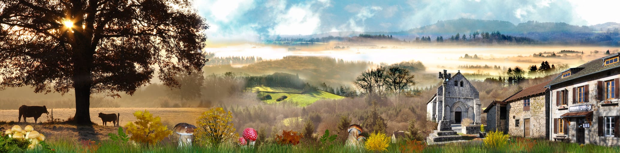
I Introduction and name of the municipality
The origin of the names of places is an invaluable help for the Historian. For our contemporaries, widely cut by their roots, their meaning remains very often a mystery. So, who would know how to recognize in « Barabant » the nickname of a boilermaker located in an old text of the XIth century? Because it goes back in the mists of time, this linguistic contribution is doubtless underestimated and deserves an in-depth study (1). I suggest examining here some origins useful for the knowledge of the past of the municipality of Cheissoux, still named usually « Cheissoux-la-Chapelle » at the beginning of the XXth century (2). It is moreover at that time that the separation of its some 1005 ha of the municipality of Bujaleuf. (3) Nevertheless, in older times, Cheissoux was sometimes autonomous, sometimes was a member of saint Léonard’s parishes, Champnètery or Bujaleuf (4). Its toponymical resources are relatively few, essentially because of its small surface (5).We meet two main themes there: the natural elements on one hand, the agricultural activities on the other hand.
Cheissoux is the name of the village. Its small Romanic church is the proof of a very old existence: in the neighborhood of 1100, the noble Pierre de Cheyssou gave his lands to saint Gaucher, founder of Aureil. The patronymic of this aristocrat comes from Latin « Cassius », followed by the suffix-onem, transformed into « Cheison ». « Lous cheisons » (pronounce: « chaï ») they are the inhabitants of places subjected to the jurisdiction of this Lord.
We have in this case the perfect illustration of the difficulties in determining the real origin of the name: is it the place which gave its name to the character or opposite (Cassius’s lands)? The place of worship is attested as cure in 1318, passing in that of saint Léonard in 1478, Bujaleuf in 1558, Champnètery by 1700, becoming again autonomous parish in 1869.
The aspect that can set the relief, the recognized approval of a site, its hydrological qualities, or still an existence of a singular vegetation, are frequent origins of the names of places. Rural district, Cheissoux does not obviously escape this rule.
II names derived of a raised relief
The form of the ground – we say skilfully « topography » – The most current in Limousin is the term « Volcanic hill ». It is borrowed from the Occitan (6 « puig ») (More formerly « pog » or « poi »), whose gallicized form it is. This word indicates a height, without notion of height moreover, although to Cheissoux we enter what the geographers call: « the Mountain Limousine ». It is found in 7 names, followed diverse more or less explicit qualifiers:
The Volcanic hill of Coutaud (env. 500 m). Situated in the hillier West of the municipality, this height is also called Bellevue (v.plus far)
The Volcanic hill of the Cheerful (449 m). Dominating the church in the South and the valley very taken of the Brook of Cheissoux in the East, the name of this hill ready for diverse interpretations. The spelling seems to send back to the synonymic adjective of « joyful ». It is the sense held by Y.Lavalade (1). But locally, we were proposed two other hypotheses. On one hand: volcanic hill of the Watch (crest adapted well to the observation) (7) in a form which we also find in the northeast, on the municipality of Auriat, near the village of Menudier. On the other hand: volcanic hill of the Jay (the bird) (8), form more poètique echoing Chantemerle, other height (431 m) dominating the village further south.
From the said hiking trail « of Puycharau », on the verge of the Creuse, in the direction of Dourdannes, we notice two summits of close height: over the Coomb (542 m) and farther northward (547m, They have no name, but are the peaks of the municipality.
The Volcanic hill the Shoe (413 m) overhangs the dam of Fleix (cf. Bujaleuf): in this place-name, « Shoe » (or « Graule ») come maybe from the oc. ( The crow) « graula ». We often find it in names indicating a mound (the crow being often perched). We find here the previous ornithological hypothesis.
The Volcanic hill the River: another summit of the western sector (527 m) is. A mystery remains as for its origin: about what river is – it? In reality, there oc., « ribiera » indicate(appoint) a ground or a wet zone, close to a stream. He could involve the valley situated on the nearby municipality of Champnètery (sector of Grosland), where we find numerous ponds today, where crosses the brook of Alesme, the tributary of Maulde.
The Volcanic hill of Rocks (516 m): this well known place for walking is surmounted(overcome) by a colossal rock (« roca » oc, but the root is in reality pre-Celtic), These rocks fed a legend. « People of the country say that the Virgin Mary would have carried(worn) them in its apron » (2). We shall notice that this meaning of a word, more geologic than topographic, is appreciably different from the form more current limousine (« roca » indicate a rocky mound separating two valleys).
Of the Volcanic hill the Fool (462 m), close to the locality Barabant, we observe the village of Texonnière on the West, various gaps from the municipality of Auriat in the North, as well as the heights of the village in the South. Oc. « Fool » has the same sense as in Frenchman, that is stupid; even there the origin is enigmatic.
The Volcanic hill Tinne (env. 440m) deal with cemetery in the western entrance of the village. A « tina » (Oc. and lat.) indicated a tank, a pond.
III Names fired by the landscapes and by the geology
Of these heights, we perceive very beautiful panoramas. It is the sense which we wanted to give to the locality « Bellevue » (v. also « The Volcanic hill of Coutaud »). Place located(localized) on a height (« a pauc on na nauteur »), its name comes from the oc. « Bella vuda », meaning a wide view, in the sense of « big ». Of this point, we have certainly a magnificent panorama on trays dominating the valley of Vienne, southward and the southwest. But the afforestation widely limited the original sense of this place.
But « most beautiful » – To understand « widest » – is visible when we climb at the top of rocks, previously quoted. Without the presence of some trees, we would have moreover a panorama in 360 °: in the South towards the Mount Gargan, in the East towards St Moreil, on the West beyond Limoges.
It would be necessary to make a spell for the term Puycharaud, although the former farm bearing this name is situated on the territory creusois of the municipality of Auriat. It is not at all about a « volcanic hill », in the previous sense. The nearby lands, today woody, which crosses the hiking trail are called: « Picharaud » (v. Charraux). They are moreover in a bottom.
The characteristics of grounds also play a role in toponymy. As often in Limousin, the granitic bedrock appears, and grounds are rocky. It gave « Pebbles soft », deformation(distortion) of the oc. « Calhaudons ». Have a rather close sense(direction) « The Fields of Coaches » (of « cair » or « kar », that is stone, which we find in numerous Indo-European roots). We also named Las Peyrieras (oc. « Peiriera »: quarry, cultivated grounds, from which it was necessary to extract big stony quantities before being able to ensemancer.
IV Names evoking the low points
Contrary to « volcanic hills », the granitic relief presents hollows called « alveoli » where skip farms and villages. The toponymy of the municipality presents several examples.
On the West, we so find: the Coomb and The Combettes (diminutive of the precedent), in the almost equivalent sense(direction). « Cumba » is a pre-Latin root indicating a valley. The observation of the map (5) and the ground illustrate well this definition. Below the first place is a valley browsed by a brook, cut by a pond, coming down towards the village of Texonnière. The farm of The Coomb is at the middle-slope. The remark also applies to the second place. As usual, our forefathers did not build either on summits, or in wet collections. A rather close direction is legible in the locality: Fondreaud, him too on a displayed(exposed) well hillside (v. following paragraph).
Irony of the toponymy, the one should have indicated(appointed) the other one and conversely. Because Combettes is the typical example Of a vast depression, with a made uneven fort. The term The Coomb would have better suited.
Small Cros, situated between The Volcanic hill the Fool and the cemetery, has an Occitan etymology (« cros » : Topographic depression). We so indicate a hollow of lesser dimension, what Y.Lavalade calls « small holes ».
V Names water-related
As everywhere in the region, there is a multitude of brooks, as well as numerous ponds of human creation. The locality « Le Fondreaud », is situated on the southwest hillside of The Coomb. This name supplies us an excellent transition because its sense is at the same time topographic (it is a bottom, a basin: oc. « Fons ») and hydrograph (a fondraud is a rut, a very wet place). Of these summits arise sources, sense contained in :
Lafont (oc. « make » : source(spring), fountain): in the side of the Volcanic hill of Rocks.
Noches (formerly Nauches, of the oc. « Nauca »: trough, or bowl of fountain) indicates a farm situated on a flat, but swampy ground, with a small pond (9).
The Drop(Gout) (of the lat. « Gutta ») is a place where from sourdent small brooks which feed Maulde.
Ganes is a puddle (oc. A ford « gana ») either which allows to cross( easily a stream (derived of the lat. « Vanum ») (9). As Fondreaud, Sagnes indicate a wet and swampy ground (oc. « Sanha »). This last place-name is very frequent in Limousin. However, the location(localization) of these two terms returns their problematic meaning.
Even darker is the sense of the place Reinders, moreover writes Réunnes on the land registry and the signpost, such as indicated on an old plan of 1935. The current inhabitants say nevertheless well Reinders. According to Y.Lavalade (1), it would be a nickname, pulled from the name oc. « Reina » (The Queen), and given to this place too swampy: « endrech marecatjos, emb back pitits estanhs ». Could not he involve a deformation of the word « reins », indicating plots of land in length, compared with strips?
VI Names evoking the vegetation and the wildlife
If the vegetation is plentiful and varied, she curiously left few tracks in the toponymy, at least in her natural forms (see farther the agricultural origins). Just one find :
Chassagnades (lat « cassanus », borrowed from the Gaul: the oak) is in front of the village of Villemonteix, on the Southern slope of the Volcanic hill of Rocks. It is more exactly about an oak grove (oc. « Chassanhada »).
Big Wood (oc. « Bosc ») occupy all the strong slope dominating the right bank of the brook of Cheissoux, since the Volcanic hill of the Cheerful. This sector is crossed by the hiking trail.
Lous Suais evokes the elder, which says to itself in language limousine, either « suec », or « soec ».
No evocation of the chestnut grove (eg The Brown), of the alder (as in Vergnes) or still of the lime tree (« tilium »: in Teilh). How to explain the place(square) if weak(weakness) of the afforestation in the local toponymy? A thesis published in 1998 under Christian Beynel’s signature (10) we brings a bait(onset) of answer. We can read it that at the beginning of XIX è century, drink them ocupaient of the extremely low(weak) surfaces (less than 10 %). However, no place calls back(reminds) either moors, of heathers or brooms (eg Janeste), known as dominant element of the landscape when we go away towards the tray(plateau) of Millevaches. The plantations of conifer are thus a recent element in the course of history and mask a reality quite different, which we could doubtless find on former(old) postcards.
Let us not leave however this paragraph without calling back three « birds » of our 2nd part: the jay (Volcanic hill of the Cheerful?), the blackbird (Chantemerle) and the crow (Volcanic hill The Shoe). Let us notice here that three concerned summits are practically aligned from north to south (?). As for the important village of Texonnière, he makes reference to the den of the badger (oc. taxonaria). I take the bet which such a word more has to see with the human nature than with the zoology.
The agrarian arrangement, bound to a former populating leads us quite naturally to observe the place-names derived of agricultural activities.
VII Names relative to the agricultural countries
« Our ancestors the Gauls » were already widely occupied to agrarian or pastoral activities. They do not seem to have marked the places which we evoke, on the very poor grounds (few Celtic roots). He was always very hard to make his living with the earth here. Nevertheless, the seniority of the populating is probably attested by the creation of a chapel. Some more recent place-names call back these ancestral activities. Here, we are well in an agrarian system fields of which were for a long time the preponderant part. Particularly well looked meadows form the first element of the country today, what C. Beynel so explains: « the traditional farmer of the Mountain was before any a ploughman, and it is not that slowly that he(it) got free of this tradition » (10).
So, Villetelle is diverted from the Latin « villa », which indicated a vast Gallo-Roman domain. The double suffix (-att / – ella) has here the value of a diminutive. For lack of dated document, it is difficult to find the period when the latter appeared. It is a great pity, because the evolution of the Latin root is very rich in sense(direction). In Villemonteix, the root is identical. We can understand(include) her(it) as an agricultural situated domain « under the mount » (oc. Mount).
We can classify in the same register :
The Field of Coaches (lat « campus ») v.previously ). The culture of cereal as the rye or the sarrazin was essential for a long time. It is what evoked a witness(baton) with Y.Lavalade: « a voucher graze, per the segle e lo bladiu » (11). An important cereal activity requires of course a mill, the name and the buildings of which we still find in the oriental limit of the municipality, on the brook of Cheissoux (5).”>5).
Also The Big Meadow (oc. « Prada »: the meadow). This last root also gave: the Meadow of House. We shall note that, in the region, we find much more often the more former(older) forms, such Prades, Pradelles, … This fact could shine of an element interesting the chronology of naming.
Perrier de Régeas comes from the oc. « Perier » (Pear tree), the second term being probably a proper noun.
Besides the terms containing the word meadow, the activity of breeding is indicated by « Le Coudert » (Oc. « Coderc » : An enclosure near the house). Jaunières, is doubtless a domain name resulting from the oc. « Jalinier » (Henhouse)
The exploitation of the forest also left tracks in:
The Coalwomen: probably a place of manufacturing of the charcoal, just like
The Vineyard in the coal (the beginning of the name is more mysterious on the other hand)
Chabannes comes from the oc. « Chabana ». We can have the former(old) track of coalmen’s huts there.
The place named(appointed) Chalibat, whose surfaces are divided between the municipalities of Bujaleuf and Cheissoux, is given as pulled(fired) by the oc « calivar » (to burn) (1). We could then move closer to him(it) to previous three localities, because the fort made uneven by these sides of Maulde can evoke with difficulty clearings (rather been attested moreover by names such: artige, écure, or still essart), absentees to Cheissoux.
VIII Other names derived of activities or human qualities
We evoked in introduction the proper noun Barabant, he was even pulled(fired) by the word indicating(appointing) a brass cauldron. It is thus about an anthropological, also recognizable root in the Occitan « barraban », affected(allocated) for one person oaf or rascal. I shall tilt for a nearby sense(direction) in the name of the village Texonnière (see before).
Ridou maybe arises from another proper noun, from Germanic origin (1): « rîd » (go on horseback(by horse)) – « Wulf » ( the wolf). But the ethnology allows to give another perspective. In past, we called often so ducks in farmyards limousines: « ritou! Ritou! ».
The character traits are not a toponymical category very prégnante in Limousin. We can recognize here one of the rare examples in Picharaud (and not Puycharaud): « picarel » serves it oc. to consider one mischievous(naughty), cunning(malignant) or used trickery; a former(old) owner of the place ?
Still let us quote: Percy (or « percin »), probably a proper noun, Fassaudant (not spotted(located)) traffic lanes are generally mentioned according to the points which they connect(bind). We so find Charrauds: passable passage between two meadows (oc. « Charrau »). The crossings left little track, while they were marked for a long time by very real crosses or typical landscape, as in The Cross of the Tree.
Mr Patinaud Michel’s texts – “All rights reserved”
Notes :
(1) cf. Yves Lavalade : « toponymical Dictionary of the Haute-Vienne », Published Lucien Souny, on 2000 [p.132-133]
(2) cf. Françoise Myrh’s work.
(3) Cheissoux became common autonomous in 1905
(4) cf. Anne–Marie Boulegue : « study of a rural parish in XVIIIè century », Master’s essay, UNIVERSITY DEPARTMENT of History, Limoges, on 1973.
(5) cf. card IGN of Eymoutiers: N 2131 E
(6) during the article, the Occitan will appear with the abbreviation oc. The same goes for lat. (Latin)
(7) Testimony of M. Christian Merliaud (2008)
(8) Mrs Yvonne Crougnaud’s testimony, been born Papounaud (2008)
(9) « moulade »
(10) « Forest and company(society) of the Mountain Limousine », C. Beynel, PULIM (Limoges) 1998.
(11) Testimony of mister André Delangle (1990) in (1)
| Map | Place-name | Chapters | Themes | Origins | Roots |
|---|---|---|---|---|---|
| Tree (Cross of him) | 8 | cf. 18 | |||
| 1 | Barabant | 1 – 2 – 8 | anthropology | occitan | barraban |
| 2 | Bellevue | 2 – 3 | relief | oc | bella vuda |
| 3 | Wood (The Big) | 6 | vegetation | oc | bosc |
| 4 | Pebbles Soft (The) | 3 | grounds | oc | calhaudon (s) |
| Coaches (The Fields of …) | 3 | cf. 7 | |||
| 5 | Chabannes (Les) | 7 | anthropology | oc | chabana (s) |
| 6 | Chalibat | 7 | forest | oc | calivar |
| 7 | Fields of Coaches (The) | 3 | agriculture/sols | Latin/Celtic | campus/cair |
| 8 | Chantemerle | 2 – 6 | fauna | ||
| Coal (Vineyard in …) | 7 | forest | oc | cherbon | |
| 9 | Coalwomen (The) | 7 | forest | cherbon | |
| 10 | Charrauds (Les) | 8 | path | oc | charrau |
| 11 | Chassagnades (Les) | 6 | vegetation | Celtic | chassaunhada |
| 12 | Cheissoux | 1 – 2 – 6 – 7 | anthropology | Oc / lat. | cheisson/cassius |
| 13 | Coomb (The) | 2 – 4 | relief | Pre-Latin | cumba |
| 14 | Combettes (The) | 4 | relief | Pre-Latin | cumba |
| Coudert (Le) | 7 | agriculture | oc | coderc | |
| 16 | Coutaud (The Volcanic hill of …) | 2 | |||
| 17 | Couteyron | ? | |||
| 18 | Cross of the Tree | 8 | path | lat | crux |
| 19 | Cros (Youngs) | 4 | relief | oc | cros |
| Fassaudant | 8 | ||||
| 22 | Fondreaud (The) | 5 | relief/waters | oc | fons |
| 23 | Font (The) | 5 | waters | oc | font |
| 24 | Cheerful (The Volcanic hill of …) | 2 – 6 | relief/bird ? | ||
| 25 | Ganes (The) | 5 | waters | oc | gana |
| 26 | Drips (The) | 5 | waters | lat | gutta |
| 27 | Shoe (Volcanic hill …) | 2 | relief/bird ? | oc | graula |
| 28 | Jaunières (The) | 7 | animals | oc | jalinier |
| 29 | Mill of Cheissoux (Le) | 7 | small business sector(crafts) | lat | molinum |
| 30 | Noches (The) | 5 | waters | oc | nauca |
| 31 | Percy (Le) | 8 | anthropology | ? | Proper noun |
| 32 | Perrier de Régeas (Le) | 7 | agriculture | oc | perier |
| 33 | Peyrieras (Las) | 3 | geology | oc | periera |
| 34 | Picharaud | 3 – 8 | anthropology | oc | picarel |
| 35 | Meadow of House | 7 | agriculture | oc | prada/maison |
| 36 | Meadow (The Big) | 7 | agriculture | oc | prada |
| 37 | Reinders (The) | 5 | ? | oc | reina |
| Puy (Le … de) | 2 – 3 – 5 – 6 | relief | oc | puig | |
| 38 | Ridou | 8 | anthropology | Germanic | proper noun |
| 39 | River (Volcanic hill …) | 2 | relief/waters | oc | ribiera |
| 40 | Rocks (The Volcanic hill …) | 2 – 5 – 6 | relief/geology | oc | roca |
| 41 | Sagnes (The) | 5 | waters | oc | sanha |
| 42 | Fool (The Volcanic hill …) | 2 – 4 | relief/anthropology | oc | sot |
| 43 | Sweated (Lous) | 6 | vegetation | oc | suec |
| 44 | Texonnière (La) | 2 – 4 – 6 – 8 | fauna | oc | taxonaria |
| 45 | Tinne (Volcanic hill) | 2 | relief/waters | oc | tina |
| 46 | Vineyard in the coal (The) | 7 | agric./relief | latin/oc | villa/mount |
| 47 | Villemonteix | 6 – 7 | agric./relief | latin/oc | villa/mount |
| 48 | Villetelle | 7 | agriculture | lat | villa |